
Contents
Overview
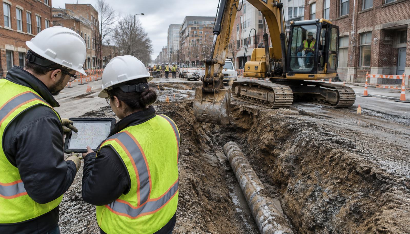
The scenario was familiar to everyone on the call: a road reconstruction already in construction, a duct bank nobody's drawings showed, and a contractor's delay claim on the city manager's desk. The panel worked backward from that moment to the decisions that could have prevented it.
They agreed on one point early. The utility problem wasn't discovered in construction. It was created in planning, when the project was budgeted on records nobody had checked. Every unknown carried past schematic design becomes a cost the city pays later, at the highest possible price.
“The change order was written in planning. We just didn't read it until construction.”
The less you know early, the more you pay late.
Key Takeaways
- 01
Most utility change orders trace back to an information gap in planning, not a failure in construction.
- 02
811 is not a complete inventory. Confirm which municipal systems are registered.
- 03
Decide a target ASCE 38 quality level per project segment before scoping the fee.
- 04
Desktop utility research now takes days, not months. Do it before the budget is set.
- 05
AI-compiled utility data is a planning tool, not a quality level. It still needs engineering review.
- 06
Move utility coordination from 60% design to schematic.
- 07
Put utility risk in the contingency line, sized to what you actually know.
- 08
Track change orders by cause so the next budget learns from this one.
The Scenario
Case file · Event 01
- City
- [Mid-size city, ~120,000 residents]
- Project
- 1.2-mile arterial reconstruction with new storm drainage and sidewalks · [$14M]
- What existed
- 811 tickets, water/sewer GIS, 1970s and 1990s as-builts, no telecom records
- Constraint
- Construction season window; two schools on the corridor
- The decision
- “How should this project have been scoped, and what does the city change before the next one?”
Expert Positions
[City Engineer]
“Why did the budget miss it?”
The project was budgeted from GIS and 811 tickets. No records research phase was funded, so the telecom duct bank never appeared in any estimate. [Summary placeholder.]
“[Pull quote placeholder]”
[SUE Engineer]
“What should the investigation have looked like?”
Match the quality level to the risk in each segment rather than applying one level to the whole corridor. [Summary placeholder.]
| Level | What it involves | When it's worth it |
|---|---|---|
| D | Records research | Every project, at concept |
| C | Records + surveyed surface features | Most corridor projects, at schematic |
| B | Field designation (EM, GPR) | Where conflicts are likely |
| A | Exposed and surveyed (test holes) | Critical crossings and tight designs |
Level: D
What it involves: Records research
When it's worth it: Every project, at concept
Level: C
What it involves: Records + surveyed surface features
When it's worth it: Most corridor projects, at schematic
Level: B
What it involves: Field designation (EM, GPR)
When it's worth it: Where conflicts are likely
Level: A
What it involves: Exposed and surveyed (test holes)
When it's worth it: Critical crossings and tight designs
“[Pull quote placeholder]”
[4M Specialist]
Vendor / practitioner-reported“What can a city know on day one?”
Compiled public records, as-builts, permits and imagery-detected surface features in one map, with sources shown where available, as a starting point for engineering review. Vendor-described.
“[Pull quote placeholder]”
The Complication
Mid-session, the moderator revealed: “The duct bank belongs to a telecom provider that isn't a member of the local 811 center, and their records show it on the other side of the street.”
The panel's recommendations shifted. Records alone aren't enough when they place a line on the wrong side of the street. Identifying every owner in the corridor became a first step, not a courtesy. And targeted spot-checks before design moved from optional to essential wherever records and reality might disagree.
The Decision Path
If this were our city:
- 1
Fund a records-research step at concept on every project over [$X].
- 2
Set quality levels by segment at schematic, and budget field verification where conflicts cluster.
- 3
Track utility change orders by cause and report them to council annually.
| Before | After | |
|---|---|---|
| When utilities are researched | At 60% design | [At concept] |
| How contingency is set | Flat percentage | [Sized to known risk] |
| Where conflicts are found | In construction | [In schematic design] |
Item: When utilities are researched
Before: At 60% design
After: [At concept]
Item: How contingency is set
Before: Flat percentage
After: [Sized to known risk]
Item: Where conflicts are found
Before: In construction
After: [In schematic design]
Evidence From the Field
From the series archive
VRX, Inc., working with 4M, delivered a 150-acre feasibility study with three costed utility servicing options in four days, one day ahead of deadline. Traditional QL-C mapping on comparable work had taken two to four months.
Source: AI-Powered Utility Data in Practice, AssetMapping.Events, June 16, 2026. As reported by the presenting firm; not independently verified.
Session case
[X]
change orders tied to utilities
[$Y]
in utility-related claims
[Z]
weeks of delay
Figures as reported by the presenting agency; not independently verified.
Field Guide
Before you budget: utility risk checklist
0/10Where desktop utility data fits
| Phase | Use | Value |
|---|---|---|
| Feasibility | Screen routes and sites against likely utilities | Defensible early estimates |
| Schematic | Starting base map for quality-level planning | Target field work where it matters |
| Field planning | Direct designating and test-hole crews | Fewer wasted mobilizations |
| Design | Cross-check against QL-B/QL-A results | Catch gaps before bid |
| Construction | Reference for crews and inspectors | Context, not a substitute for locates |
Phase: Feasibility
Use: Screen routes and sites against likely utilities
Value: Defensible early estimates
Phase: Schematic
Use: Starting base map for quality-level planning
Value: Target field work where it matters
Phase: Field planning
Use: Direct designating and test-hole crews
Value: Fewer wasted mobilizations
Phase: Design
Use: Cross-check against QL-B/QL-A results
Value: Catch gaps before bid
Phase: Construction
Use: Reference for crews and inspectors
Value: Context, not a substitute for locates
Questions to ask any utility data provider
- Which sources feed each line, and is the source shown?
- Is any confidence level attributed?
- What's covered in our state today?
- What export formats fit our GIS and CAD?
- How are field corrections incorporated?
- What should we still verify in the field?
Crawl
Run desktop utility research on one upcoming project; compare it with the old process.
Walk
Make it a standard concept-phase step; track change orders by cause.
Run
Build quality-level targets and utility contingency into every capital project.
Audience Polls
Multi-select questions do not total 100%. Placeholder data shown.
Organization type
PlaceholderMunicipality population
PlaceholderWhere do you most often discover utility problems?
PlaceholderHow does your agency collect utility data today?
PlaceholderThe Signature Poll · Event 01 Placeholder
“How confident are you in what’s under your next project?”
- Very confident [8%]
- Fairly confident [27%]
- Unsure [31%]
- Not confident [22%]
- We don’t know what we don’t know [12%]
Underground Confidence Index
[49] / 100
Event 01 baseline
Feeds the year-end report: The State of Underground Knowledge in Local Government
Experts vs. Room: “Your corridor budget is due next week. What do you do first?”
- A. Budget from GIS and 811 [31%]
- B. Commission records research [22%]
- C. Desktop utility map, then targeted field work Panel pick[34%]
- D. Add a larger flat contingency [13%]
[Panel reaction placeholder] The panel noted that the room split closely between budgeting from existing records and a desktop-first approach, and discussed what it would take to make records research a default step.
Full Q&A
How do we justify paying for records research before a project is approved?+
[City Engineer]: [Answer placeholder — to be replaced with the session transcript.]
What if our own water records are the worst ones?+
[4M Specialist]: [Answer placeholder — to be replaced with the session transcript.]
Can AI-compiled utility data be used in a bid package?+
[SUE Engineer]: [Answer placeholder — to be replaced with the session transcript.]
How do we handle utility owners who won't share records?+
[City Engineer]: [Answer placeholder — to be replaced with the session transcript.]
What contingency percentage is reasonable for utility risk?+
[SUE Engineer]: [Answer placeholder — to be replaced with the session transcript.]
How do we get council to fund work that prevents a problem they never see?+
Greg Babinski, GISP: [Answer placeholder — to be replaced with the session transcript.]
[Moderator's note placeholder] On the ROI case: a formal benefit–cost study would strengthen this argument.
Glossary
- SUE
- Subsurface Utility Engineering: the engineering practice of locating, characterizing and depicting existing utilities.
- ASCE 38-22
- The national standard for collecting and depicting existing subsurface utility data.
- Quality Level D
- Information from existing records or oral recollection.
- Quality Level C
- Records plus surveyed visible above-ground utility features.
- Quality Level B
- Utilities designated in the field with geophysical methods.
- Quality Level A
- Utilities exposed and surveyed at specific points, usually by test hole.
- 811
- The national call-before-you-dig number that routes locate requests to member utilities.
- Locate / paint marks
- Temporary surface markings showing the approximate position of buried utilities.
- APWA color code
- Standard colors for marking utilities: red electric, yellow gas/oil, orange communications, blue water, green sewer/storm, purple reclaimed.
- As-built
- A drawing intended to show what was actually installed.
- Utility conflict
- A location where a utility interferes with proposed construction.
- Utility coordination
- Managing communication, design and relocation with every utility owner on a project.
- Change order
- A formal change to a construction contract's scope, cost or schedule.
- Delay claim
- A contractor's request for compensation for time lost to conditions outside their control.
- Contingency
- Budget held for unknowns.
- Schematic phase
- Early design, when alignments and major elements are set.
- Feasibility estimate
- An early estimate of whether and at what cost a project can be built.
- Conflation
- Merging data from multiple sources into one consistent dataset.
- Object detection
- Automated identification of features, such as manholes or valves, in imagery.
- Abandoned utility
- A line no longer in service but still in the ground.
- Duct bank
- A group of conduits encased together, often in concrete, carrying power or communications.
Speakers
Greg Babinski, GISP
Moderator · Founder, GIS Management Academy
Founder of GIS Management Consulting Services and the GIS Management Academy; past president of URISA (now the Geospatial Professional Network); American Geographical Society Ethical GEO Fellow; long-standing focus on GIS return on investment.
[4M Specialist]
[Title], 4M Analytics
[Bio placeholder]
[City Engineer]
[Jurisdiction]
[Bio placeholder]
[SUE Engineer]
[Firm]
[Bio placeholder]
About the Organizations + Resources

AI-powered utility mapping platform that compiles public utility records, as-builts, permits and imagery-detected surface features into one map for planning, design and pre-construction. Capabilities and coverage are subject to change; confirm current specifications with 4M.
[Agency] · [SUE firm] · GIS Management Academy
Continue the Series
- Event 01 — The Change Order Nobody BudgetedYou are here
- Event 02 — The Grant Application Due FridayRegister
- Event 03 — The Fiber Build That Hits EverythingRegister
- Event 04 — The Lead Line DeadlineRegister
- Event 05 — Six Owners, One StreetRegister
- Event 06 — The Map That RetiredRegister
Publishing at series wrap
The State of Underground Knowledge in Local Government
This report was compiled from the presentation recording and transcript. Statements are attributed to the speaker who made them and reflect their views rather than those of their employers. Product capabilities described reflect what was stated during the presentation and are subject to change. Logos: Asset Mapping Insights · ConnectMii Events · AssetMapping.Events.